The Toledo Lucas County Sustainability Map makes it easier for residents, businesses/organizations, and educators to connect with green resources in the Toledo-Lucas County area and engage in local sustainable activities.
Toledo Lucas County Sustainability Map
sites
User Submission: This is a wetland pond that has nature preserve potential.
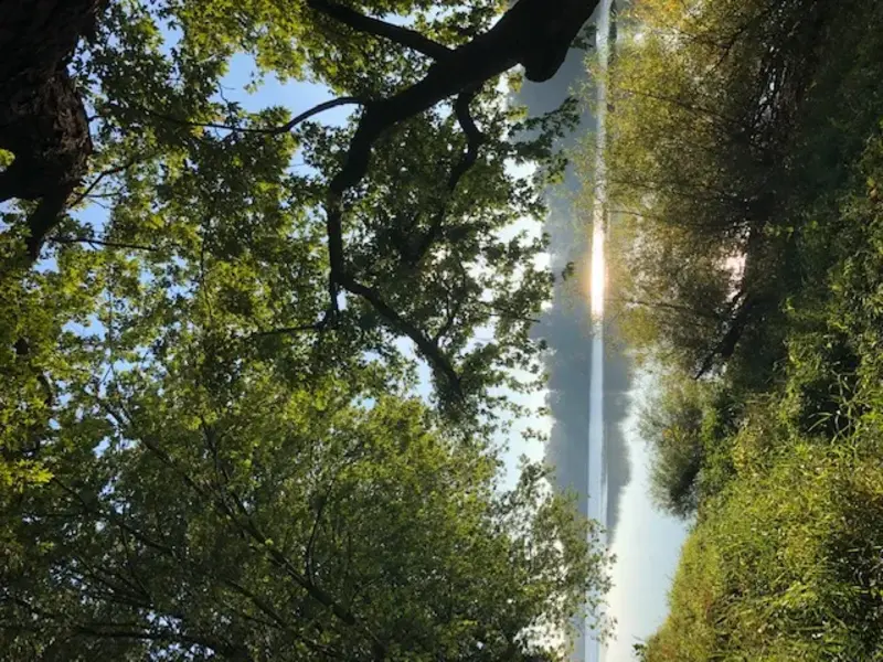
User submission: This seems to be a manmade canal that is a spur off of the now filled-in Wabash & Erie canal that ran from the town of Manhattan as the entry to the Maumee River by, up to the ent...
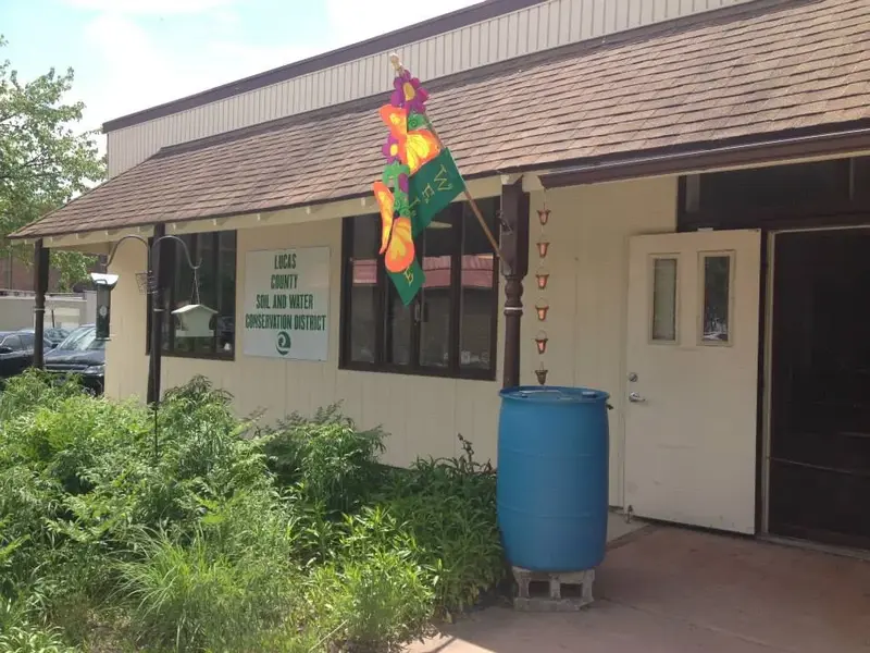
The Lucas Soil & Water Conservation District is a subdivision of state government that promotes best management practices of natural resources within Lucas County, Ohio. Located at 130 W Dudley St, Ma...
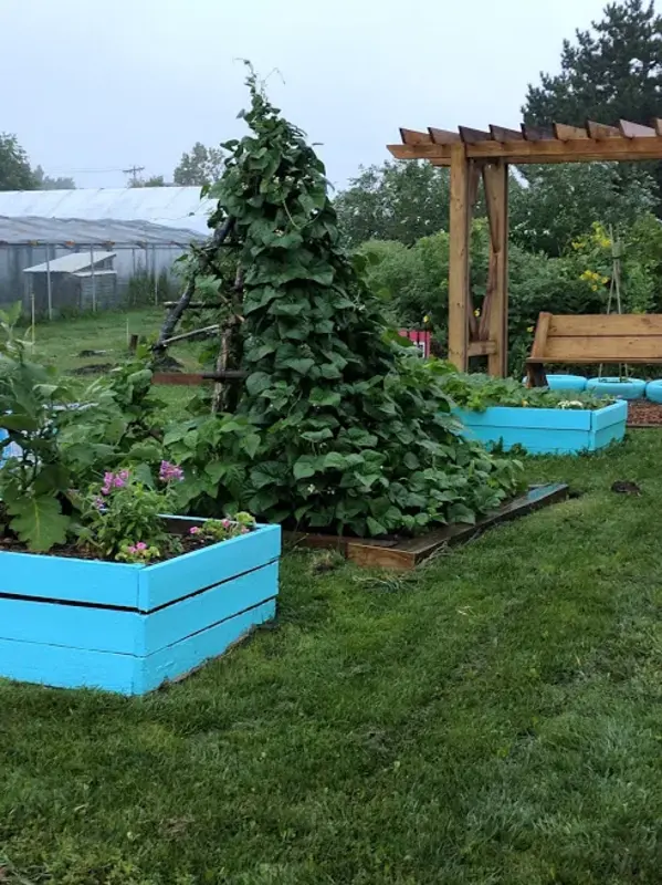
Community gardening resource organization located at: 900 Oneida Street Toledo, OH 43608. Learn more at www.toledogrows.org/ or by calling 419-720-8714. Icons: Community Garden;G...
Open park owned by Metroparks Toledo with: bbq grill, drinking fountains, fishing, ice rink, nature area, parking, benches, picnic shelter, picnic tables, play equipment, restrooms, sledding, wal...
Rain Garden at Riverview Park. Icons: Water Recycling
Open park owned by Metroparks Toledo with: fishing, nature area. Parking available at Sidecut Metropark, 1025 W River Rd, Maumee, OH 43537. Access to the island is seasonal depending on water le...
Open park owned by City of Maumee with: fishing, nature area, parking, benches, restrooms, walking trail(s). Address: 412 River Rd, Maumee, OH Icons: Park or Recreation Area;Native Forest or Plants;...
Open park owned by City of Toledo with parking, nature area. Address: 6303 Dorr St, Toledo, OH Icons: Park or Recreation Area
Open park with baseball diamond and historic caboose, owned by Village of Holland. Address: 7101 Front St, Holland, OH. Learn more at: https://www.hollandohio.com/rail-park/ Icons: Park or Recrea...
Open park owned by Metroparks Toledo with: drinking fountains, nature area, rain garden, benches, picnic tables, restrooms, walking trail(s), reservable space, bike racks. Address: 5403 Elmer D...
Rain Garden at the Lucas County Engineer's Office. Address: 1049 S McCord Rd, Holland, OH 43528 Icons: Water Recycling
Rain Garden at Locust Street Rain Garden Icons: Water Recycling
Rain Garden at Bowsher HS Icons: Water Recycling
Open park owned by Metroparks Toledo with: fishing, rain gardens, nature area, parking, restrooms, and walking trail(s). Also home to Nature's Nursery Center for Wildlife Rehabilitation and Conservat...
Open park owned by Metroparks Toledo with: bbq grill, drinking fountains, nature area, rain garden, parking, benches, picnic shelter, picnic tables, play equipment, restrooms, walking trail(s)...
In 2017, the Burroughs Neighborhood Organization (BNO) was one of three organizations awarded The Toledo-Lucas County Sustainability Commission's Sustainable Neighborhoods Grant. Since then, BNO has s...
Open park owned by City of Toledo. Address: 620 Detroit Ave, Toledo, OH Icons: Park or Recreation Area
Approximately 2.5-mile park trail with imported material surface, 10 feet wide, restricted hours. Learn more at: https://metroparkstoledo.com/explore-your-parks/swan-creek-preserve-metropark/trail-lis...
Approximately 0.67-mile park trail with hard surface, 8 feet wide, unknown restricted hours. Learn more at: tmacog.org/transportation/walking-biking Icons: Bicycle Path
Approximately 1.05-mile park trail with hard surface, 7 feet wide, unknown restricted hours. Learn more at: tmacog.org/transportation/walking-biking Icons: Bicycle Path
Approximately 0.3-mile path with hard surface, 10 feet wide, unknown restricted hours. Learn more at: tmacog.org/transportation/walking-biking Icons: Bicycle Path
Approximately 0.03-mile path with uknown surface type, unknown width, unknown restricted hours. Learn more at: tmacog.org/transportation/walking-biking Icons: Bicycle Path
Approximately 0.53-mile path with hard surface, unknown width, unknown restricted hours. Learn more at: tmacog.org/transportation/walking-biking Icons: Bicycle Path